Raster Big Data Processing using Spark with GeoTrellis
When dealing with continuous data types like elevation and satellite imagery, raster data proves to be more advantageous. Existing techniques convert raster data to vector data for processing, which results in a loss of detail, reduced accuracy, and modification of the original data. This study aims to enhance the processing and analysis of extensive raster datasets while maintaining high precision and minimal data loss. To achieve this objective, the capabilities of GeoTrellis and Docker have been utilized. GeoTrellis can handle large-scale data processing without conversion and supports various raster data storage formats. Docker is employed to distribute computation across a cluster, ensuring that the solution can complete complex tasks efficiently within a reasonable timeframe. Furthermore, the proposed system architecture offers a collection of algorithms that handle data and expedite the output of ad-hoc queries.
The paper has been accepted to the 2nd International Conference on Computing, Communication, and Learning (COCOLE)-2023 to be organized by the National Institute of Technology, Warangal for presentation.
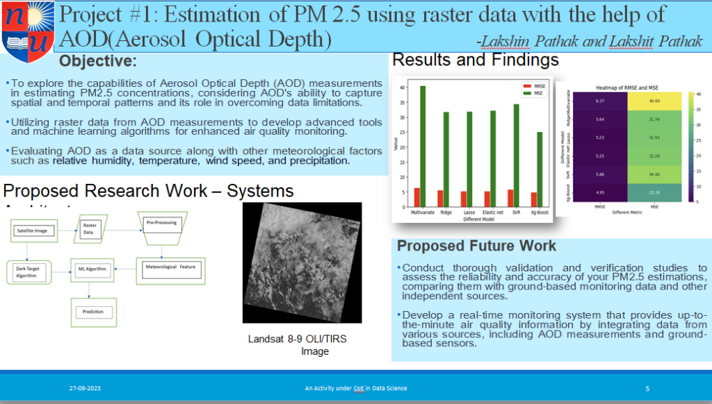
Estimation of PM 2.5 using raster data with the help of AOD(Aerosol Optical Depth)
Ongoing Projects
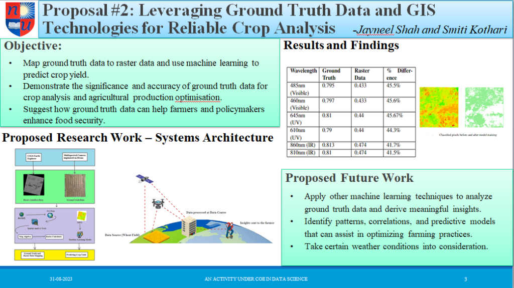
Crop Analysis via Ground Truth using Raster Data
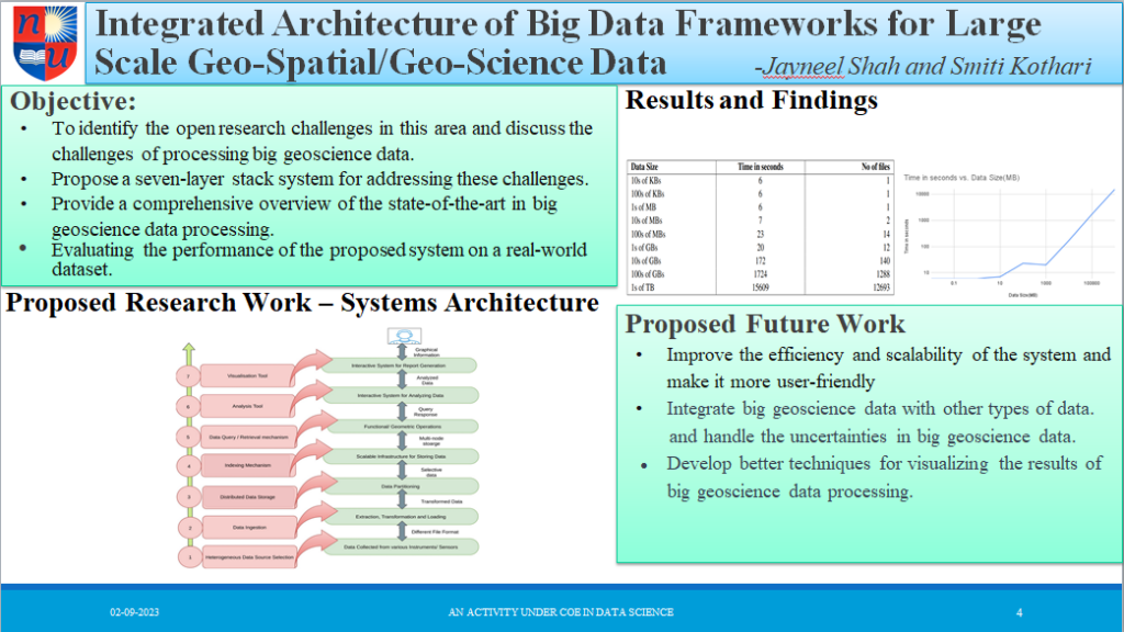
Integrated Architecture of Big Data Frameworks for Large Scale Geo-Spatial/Geo-Science Data
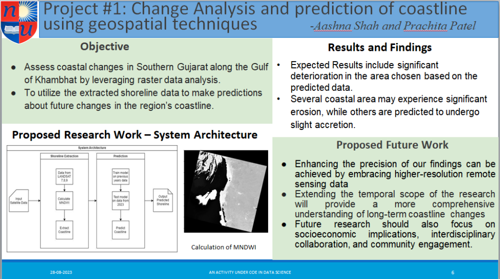
Coastline Analysis using Raster Data
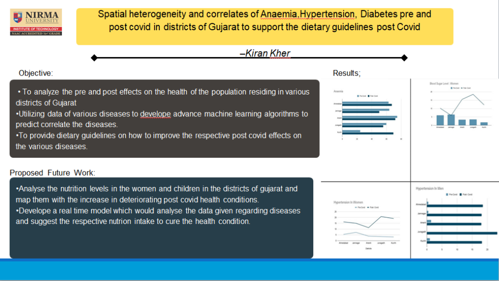
Spatial heterogeneity and correlates of Anaemia, Hypertension, Diabetes, pre and post covid in districts of Gujarat to support the dietary guidelines post Covid
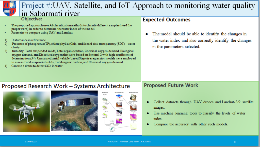
UAV,Satellite, and IoT Approach to monitoring water quality in Sabarmati river
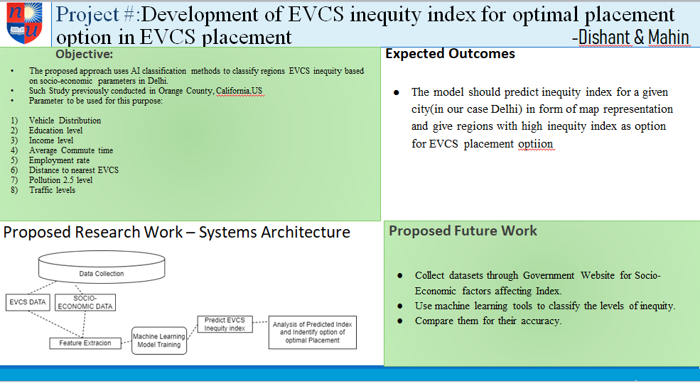
Development of EVCS inequity index for optimal placement option in EVCS placement
Understanding the impact of Atmospheric aerosols on vegetation health using AOD(Aersosol optical depth)